Reading about Moosilauke, it was clear that it would be one of the more popular hikes on this endeavor. The main route is composed of carriage trails and relatively easy trail which pay off with one of the most stunning views of any mountain in the state. I envisioned a day of parking lot jostling and crowded trails and craved a more solitary experience. And so I decided to try a different route.
Not to go all Robert Frost, but there was a road less traveled–the Benton Trail via Tunnel Brook. This offered a back door to Moosilauke that would be a bit more rustic and remote. I mapped my route and started doing a little research. There was a brook crossing involved which might be a challenge after a few days of heavy rain, but overall it seemed like the trail for me.
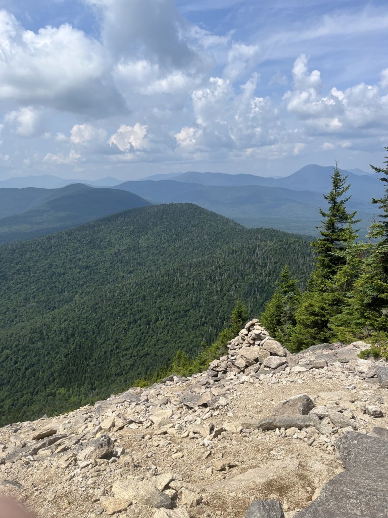
Arriving at the trailhead, I knew that I had picked well. There were only two cars in the small lot and I could instantly hear the rush of flowing water nearby. This was going to do just fine.
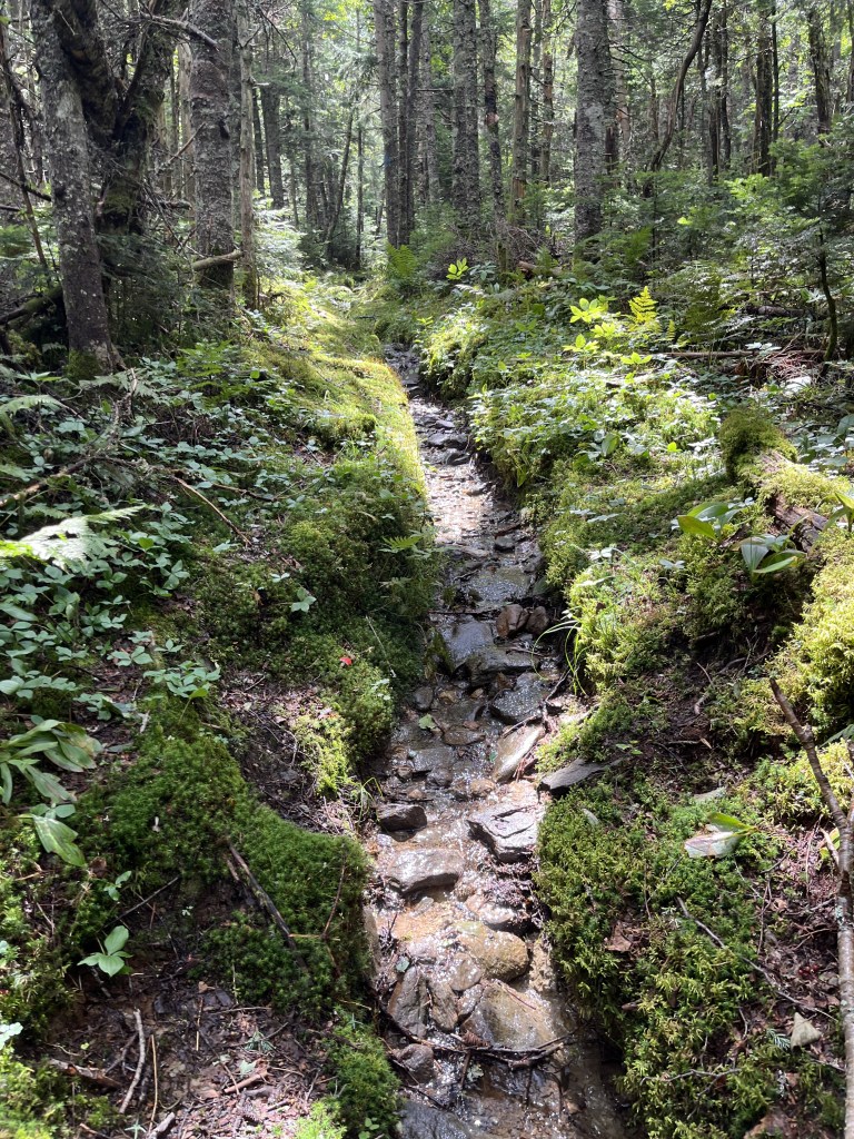
It was instantly clear that the heavy rain was going to have an effect on this hike. The water was straight up running through the woods at points. I soon came upon a part of the road/trail that had been eaten in one big bite by a raging flood at some point in the last few years.
The next challenge was the brook that I had read about. It was indeed flowing mighty. After a few minutes exploring for an easy crossing, I resigned myself to wet shoes and waded through the crystal cold water.
After the brook, the trail took the familiar mix of rock and roots that the Whites have to offer. Some sections of trail were pure stream. I didn’t see another person on the ascent or descent.
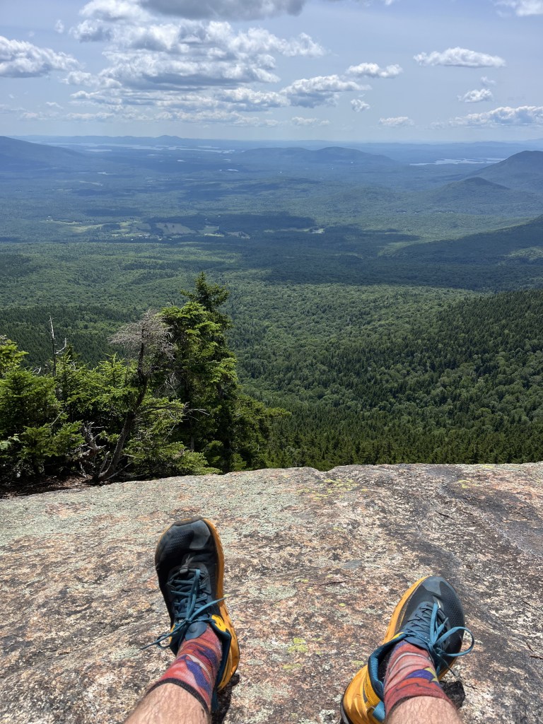
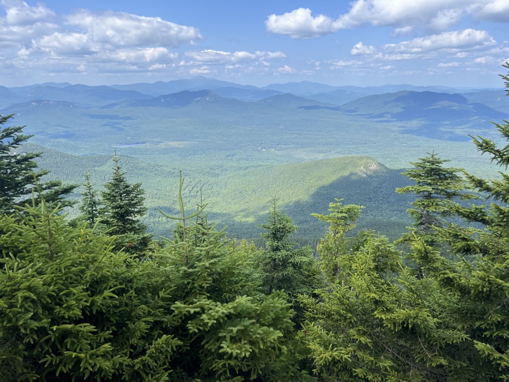
The summit lived up to the hype. I heard a guide who was stationed at the top explaining that Moosilauke translates in Abenaki to “bald place.” The top was indeed as bald as Vin Diesel, offering panoramic views that I hadn’t been treated to on any of my peaks so far. Five or six other groups of hikers relaxed and chatted, some with dogs. It wasn’t the insane gold rush for views that I had read about in my research, but still relatively busy compared to other hikes I’d done thus far.
Making my way to the South Peak for some additional views, a hiker passed by. There was a thunderclap moment where I thought it was my close friend who had passed away years ago. He was a dead ringer. We gave each other a grin–the same one that he used to give and then continued our separate paths. It was nice to know that he was still out there enjoying it all.
Coming down I anticipated the brook crossing the entire time, but this time with relish. I couldn’t wait to soothe my sore feet and calves in a cold bath. I tromped through the crossing without a second thought, made it back to my car and bathed completely in the fast-flowing water before making the long drive home.
Distance: 18.96km
Time: 4 hours 44 minutes
Music: Bob Dylan The Rolling Thunder Review: The 1975 Live Recordings
The summer started with a stumble. Midori fell sick and our plans for leading a student trip to South Africa along with taking in the sights and sounds of the Paris Olympics with her family were put on hold. She is fine, but travel was impossible.
And so a packed summer evaporated and left behind a formless mist of time so large that it was simultaneously daunting and fleeting. I began to fill the days with a routine of reading and running that in the midst of the school year would have been the ideal, but this soon formed the grooves of the mundane. The days took on the low-key saccharine buzz of a sugar high. All of the promises we make ourselves when busy, the “When I have the time I will…’s” had become anxiety clouds that hung in the air. Structure was needed, a goal was ached for.
At some point in those formless days I began to dwell on my time in Jeju. How I had managed day-long hikes up Mt. Halla and daily morning runs. How I had felt a sincere connection to the hard pumice earth there that Massachusetts hasn’t offered. I had the cliche moment of running my hand over the excess flab that had accumulated in my midsection–the remnants of a challenging year that had resulted in self-leniency. The hurdles of life that had served as excuses for escaping into nature. It dawned on me: I needed to pound my feet into some trails.
Two hours to the north of me is a veritable playground of peaks, streams and forests. It’s some of the most gnarly land you’ll find in the country, notorious to the initiated for its poking, tripping, plodding trails that strong-arm you into slow-motion. From the back of my mind the idea of the New Hampshire 4000 footers began to drift into the forefront, a 48 peak challenge that scatters the state. I soon found myself paying for overnight shipping of the White Mountains Guide and digging out gear. I moved aside the bulk paper towels and bags of dog food and reached back to grab my trusty red running pack, my hiking poles and a water filter. A wave of equal parts nostalgia and anticipation glowed in my chest. I had a goal: I was going to do the 48 4000 footers of New Hampshire before I turned 40.
This was one of the closest hikes to me and is on the eastern edge of the Sandwich Range wilderness. The parking lot is on the edge of a gorgeous farm field and I was initiated into a familiar trend in the Whites: enjoyable gradual trail early on that leads to dramatic scrambling and bouldering near the summit. Getting to the top of Whiteface was a quick reminder of how out of shape I was. Halfway through the final push the strong impulse to turn around and call the whole thing off slipped into my brain then magnified into an incredibly tempting fixation. I slurped down an energy gel and pushed on.
Atop Passaconway, the second peak, I met another enthusiast named Keenan. We chatted from the stunning lookout. When I complained about the two hour drive he put things into perspective. “Tell me about it. It was three and a half hours from Connecticut. But how nice was that scramble up Whiteface? You need to check out the Tripyramids, I did them last week!” Keenan had been racking up mountains with an enthusiastic ferocity that I took with me down the mountain.
Two peaks done.
Distance: 19.07km
Time: 5 hours 20 minutes
Music: Phish Clifford Ball ‘96
Post-run Food: Trader Joe’s Orange Chicken and white rice
Emboldened by my successful first hike, I mapped out a route that would check off three more peaks. Starting with a quick ascent up Mount Cannon, I could then work my way over to the Kinsmans. Cannon proved to be a maw of granite teeth that took bites of me going up and down. Below was a stunning view of Lonesome Lake. As I staggered to the wooden lookout, I began to realize that something was off. The top was flooded with refreshed-looking tourists and summer camp kids. Three elementary-aged boys ran up to me and bragged about how they could easily have done the same hike. Confused, I looked to my left to see a gondola lift cruising care-free tourists to the top. I chatted with a couple from Montreal, refilled water, then moved on.
The rest of the day took me to the Kinsmans which was my first contact with the Appalachian Trail. I spent some time with a thru hiker named “Offgrid” and daydreamed about the simplicity of his existence. We parted ways at South Kinsman as he floated south on the trail, Georgia-bound. The descent was more than I bargained for, partly because I decided to take the “scenic route” to Cascade Brook Trail. This proved to be more brook than trail and had me meandering around intricate root systems while finding footing on slippery rocks. I stopped and greedily drank the clear filtered water from the brook. By the time I hit Lonesome Lake and made my way through Lafayette Campground, I had a hollow look in my eye. I knew because as I walked by a campsite with a family of four, a little girl stared in curious horror.
I was cruising now. My body was responding to the trails and I could feel strength returning. I decided to give the Tripyramids a…try. It was the usual gradual trail to begin with through some well-maintained biking trails. The trickle of water accompanied my early steps. Birds sang. It was great, until it wasn’t.
An hour later I found myself clinging to the side of a boulder, exhausted, trusting the grip on my bulky trail-running shoes. The sun searched for open skin to inflict its rays upon. I didn’t want to look up because every time I did it was another demoralizing slant of steep granite.
The Tripyramids are notorious for the chute of rocks that lead to its peak. The reality met reputation as I slogged to the top step by step, every few minutes leaning on my poles for a break and sucking water. I had a mantra to just keep going up. This mantra eventually took me to a final large boulder where I slumped down and took in the stunning views. I was so intent on going up at that point that I missed the official trail to the left and bushwhacked through profanity-inducing brush for the last bit to the top.
Coming down was some of the best trail to date. A pristine brook to the left offered constant temptation to stop for a swim. A trailrunner zoomed by in the final miles and we talked about the difficult trail while making plans to get a run in together at a future date. I took a dip in the Mad River then began the long drive home.
Distance: 20.51km
Time: 5 hours 35 minutes
Music: Edward Sharpe and the Magnetic Zeros Essentials
This was the simplest of my ascents so far. A loop that would hit the two Hancock Peaks. The first section of the trail was deliciously runnable and the mile leading to the summit offered a challenge that I was starting to relish by now. Something had turned after the Tripyramids and I found that I was actually starting to enjoy the scrambles. I chatted with a couple at the summit who were on high bird alert after seeing a family of Ruffed grouse. The parking lot has a quintessential White Mountain view which attracts tourists like ants to peanut butter. After a relatively quick hike, I spread out my sweaty gear on a picnic table. “Nice hike, eh?” Said a biker who had stopped with his wife to take in the view. I nodded and grinned. “I love this area. Take it easy brother,” he said before getting onto his hog and cruising on down the road.
Distance: 14.87km
Time: 2 hours 48 minutes
Music: The Grateful Dead 8/7/71 Golden Hall, San Diego, CA